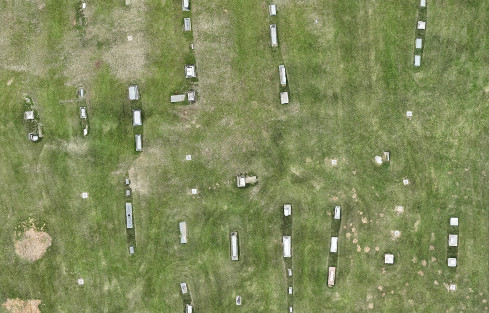
Sentry Mapping provides Ground Penetrating Radar (GPR) services to graveyards and cemeteries across the United States. Our grave locating and cemetery mapping services are designed to provide Cemetery Managers and organizations with the exact locations of each burial site on their grounds.


GPR works to locate unmarked or lost graves by sending radar signals into the earth to detect disturbed soil and voids in the earth. With each grave in your cemetery accurately located you will gain a more complete picture of the subsurface layout of the ground.
GPR systems use antennas that transmit signals into the surface of the Earth. As these signals meet different materials underground, they are reflected back to the receiver. When this process is repeated over a specific area it is called a GPR scan. This process helps determine the location of soil disturbances and underground voids where known and unknown buried remains are located.


Each portion of the cemetery that is being scanned is sectioned off into a grid. Then the GPR system passes along the grid lines until every square foot of space is covered. The GPR field technician will mark the spot where each hyperbola appears on the display screen. A hyperbola indicates that there is disturbed Earth in that area, signifying a gravesite.
Grave sites that are 50 years old or more produce a less distinct hyperbola in the GPR data. However, the highly experienced GPR field technicians with Sentry Mapping have the training to detect even the slightest evidence of disturbed soil that indicated a burial.


Determine the exact location of known and unknown burials with GPR scanning technology. Whether you have general details of the grave’s location, or you are unsure if a burial exists there or not – our team of GPR professionals will find the answers to your questions and ensure you have an accurate understanding of the area’s subsurface topography.


Some graves that are particularly old, have had their headstones damaged, or were originally left unmarked can be misplaced or lost over time. With our state-of-the-art ground penetrating radar technology, Sentry Mapping’s team of experts is able to detect the location of even the oldest of burial sites.
We provide GPR grave locating services throughout the United States to churches, cemeteries, organizations, and even private landowners. Additionally, we offer Cemetery Mapping with GPR as well as Cemetery GIS services. We also provide utility mapping services for cities and municipalities across the country.


Sentry Mapping provides state-of-the-art GRP grave locating services to cemeteries and graveyards all across the United States. Our team of professionals is standing by ready to answer any questions you may have regarding our services and deliver your quote. Contact us today to learn more about how we can help you locate graves in your cemetery.
Discover our powerful cemetery management software solution by Sentry Mapping & Chronicle.
Preserving heritage at a 150-year-old cemetery.
Problem:
A 150+ year-old historic cemetery faced a significant challenge: it had no records or maps of its burial sites. This lack of documentation left the caretakers unsure about the availability of space for new burials, raising concerns about the preservation of the cemetery’s heritage and the respect due to those interred.
Solution:
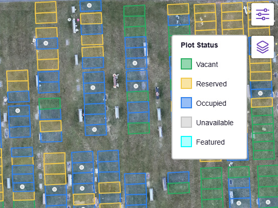
Sentry Mapping Services stepped in with a comprehensive approach to solve the cemetery’s challenges. Utilizing advanced Ground Penetrating Radar (GPR) technology, the team meticulously scanned the entire area to locate unmarked graves. This thorough investigation was followed by the creation of a detailed map that not only marked every known burial but also included names, birth and death dates, creating a rich tapestry of the cemetery’s history. To complement this, Sentry Mapping provided a clickable and searchable web map, making navigation and management effortless for the caretakers—all at no additional cost.
Result:
Thanks to Sentry Mapping’s expertise, the cemetery now has a clear understanding of its layout and capacity for future burials. This newfound knowledge ensures that every inch of sacred ground is used respectfully and efficiently, honoring the memory of those at rest. Moreover, the digital tools provided have secured the cemetery’s heritage for future generations, making it easier for families and historians to connect with their past. The once uncertain terrain of the cemetery is now a carefully mapped and cherished space, its legacy preserved and its management streamlined.

You have a beautiful cemetery with well-manicured lawns and gorgeous, serene landscaping. But there’s one major problem:…

Cemeteries are a beautiful and often serene place. They offer a place to remember those who have…
Your cemetery deserves a detailed map that shows every burial spot, both marked and unmarked. This makes managing your space easier, saving you time and trouble, and keeps your records up to date without any hassle. Our friendly team is ready to help you with any questions and guide you through every step of the process. Please fill out or form or give us a call at 901-490-6206.