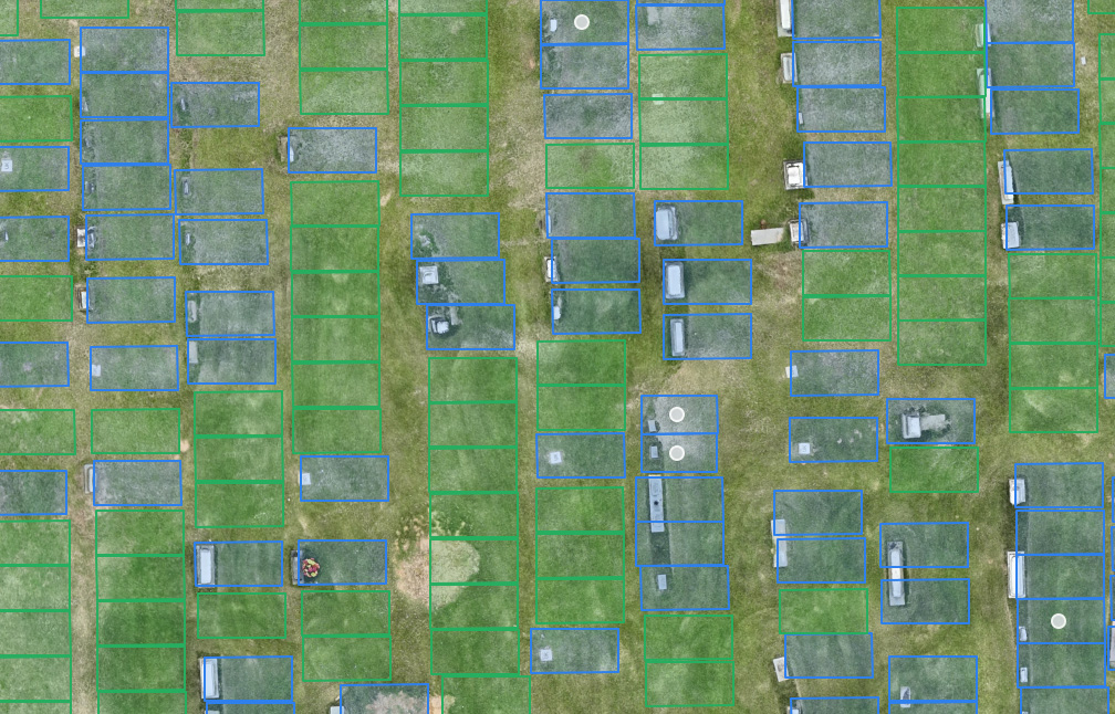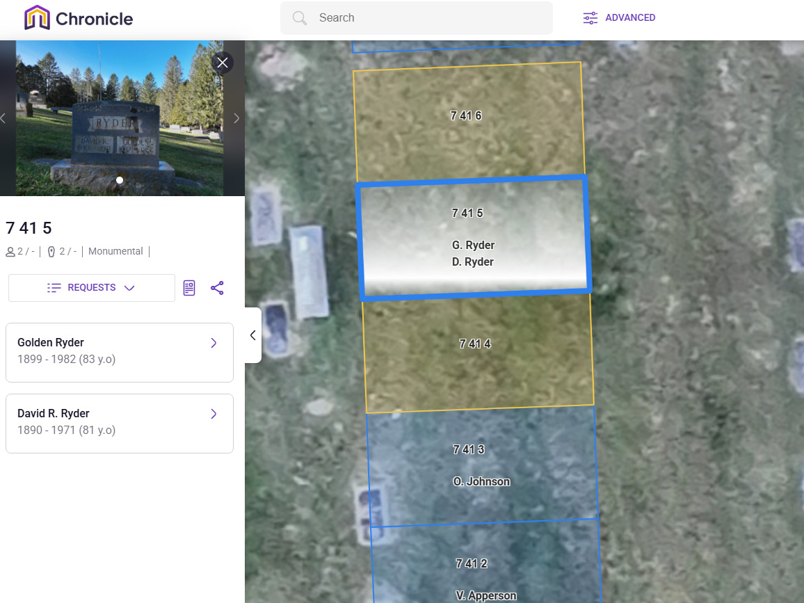
Sentry Mapping offers a cemetery asset management solution designed to help you easily preserve the history of your cemetery. Using specific data points, we create spatial maps that visualize, analyze, and interpret your cemetery’s burial plots. This state of the art Geographic Information System (GIS) is the future of cemetery asset management.


Plan for the future with precise spatial mapping of your cemetery grounds. Our GIS services make maps that show detailed information about the deceased for each burial plot. This lets cemetery managers create a valuable history record that can be maintained over time.
Geographic Information Systems simplify cemetery management, planning, and can help visitors find a loved one’s exact burial location quickly.
The Sentry Mapping team provides GIS services that gather spatial data. This includes longitude, latitude, and other geographic coordinates for each burial located within the grounds. This data can be combined with demographic information, such as the deceased’s name, birth & death dates, and any military association if applicable.
With this level of detail GIS can offer a rich resource of historical data. OUR GIS spatial analysis will also include burials that may not be present in your current cemetery records. These plots will be indicated with a note stating there is a high likelihood of an unmarked burial. This helps by ensuring it will not be mistakenly disturbed or double sold.


Cemetery GISs are used to study historical burial grounds and allow scientists to learn more about the population interred there. Many military cemeteries are now able to forecast the number of veterans that will need to be provided for each year. This is done by using historical demographic and GIS data to make a prediction of potential current demands.
Archaeologists and historians have been using these GISs to study ancient burial grounds and cemeteries for years. However, the technology is now becoming more widely available for private sector use. Sentry Mapping provides this essential service to cemeteries and organizations throughout the United States.


GISs are the perfect asset management solution for both historic and developing cemeteries. It is vital to ensure careful record-keeping that will be maintained accurately for decades to come. This industry is plagued with missing, misrecorded, or destroyed records that make it difficult to effectively plan for the future.
Ensuring that cemetery records are properly maintained and updated is vital to protecting our collective heritage. This process offers preservation data that can be used to determine which areas of the cemetery require conservation and renewal efforts. With GIS, caretakers can guarantee the respectful and efficient operation of their cemeteries.
Sentry Mapping provides this GIS service to cemeteries ranging in size all across the United States. Our team of experts is standing by to discuss your needs and provide you with a free quote. Call or fill out the form today to speak with one of our knowledgeable representatives and have your questions answered.

Discover our powerful cemetery management software solution by Sentry Mapping & Chronicle.
Preserving heritage at a 150-year-old cemetery.
Problem:
A 150+ year-old historic cemetery faced a significant challenge: it had no records or maps of its burial sites. This lack of documentation left the caretakers unsure about the availability of space for new burials, raising concerns about the preservation of the cemetery’s heritage and the respect due to those interred.
Solution:
Sentry Mapping Services stepped in with a comprehensive approach to solve the cemetery’s challenges. Utilizing advanced Ground Penetrating Radar (GPR) technology, the team meticulously scanned the entire area to locate unmarked graves. This thorough investigation was followed by the creation of a detailed map that not only marked every known burial but also included names, birth and death dates, creating a rich tapestry of the cemetery’s history. To complement this, Sentry Mapping provided a clickable and searchable web map, making navigation and management effortless for the caretakers—all at no additional cost.
Result:
Thanks to Sentry Mapping’s expertise, the cemetery now has a clear understanding of its layout and capacity for future burials. This newfound knowledge ensures that every inch of sacred ground is used respectfully and efficiently, honoring the memory of those at rest. Moreover, the digital tools provided have secured the cemetery’s heritage for future generations, making it easier for families and historians to connect with their past. The once uncertain terrain of the cemetery is now a carefully mapped and cherished space, its legacy preserved and its management streamlined.

Create a Detailed Plot Map With These Tips! If you are responsible for managing a cemetery, then…

How Cemeteries Can Use GPR For Future Planning When planning for a cemetery, mapping is an important…

How to Avoid These Common Pitfalls If you are a new cemetery owner, you may be wondering…
Your cemetery deserves a detailed map that shows every burial spot, both marked and unmarked. This makes managing your space easier, saving you time and trouble, and keeps your records up to date without any hassle. Our friendly team is ready to help you with any questions and guide you through every step of the process. Please fill out or form or give us a call at 901-490-6206.