Take the guesswork out of your cemetery management with Sentry Mapping’s Ground Penetrating Radar (GPR) services. Let us help you see what’s underground without digging, improve your records, and preserve your cemetery’s heritage.
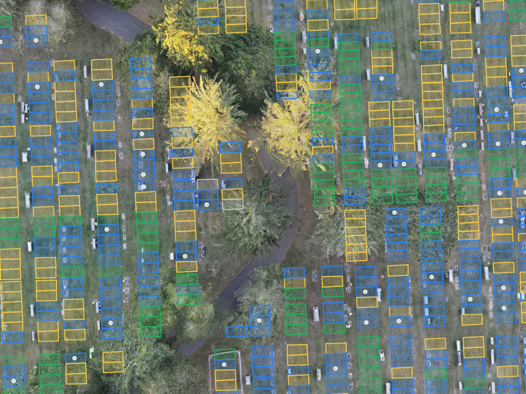
Sentry Mapping is a dedicated cemetery mapping company utilizing GPR services to offer professional subsurface mapping solutions across all 48 Contiguous United States. Our team of experts is equipped with state-of-the-art GPR/GIS technology that can identify each individual grave in cemeteries of any size. We specialize in creating detailed burial plot maps to help you maintain accurate records and plan for the future with precision.
Our Ground Penetrating Radar (GPR) services accurately identify every burial site to honor and preserve your cemetery’s legacy.
Transform your management approach with our detailed, as-built maps and digital records, ensuring you never lose track of a grave again.
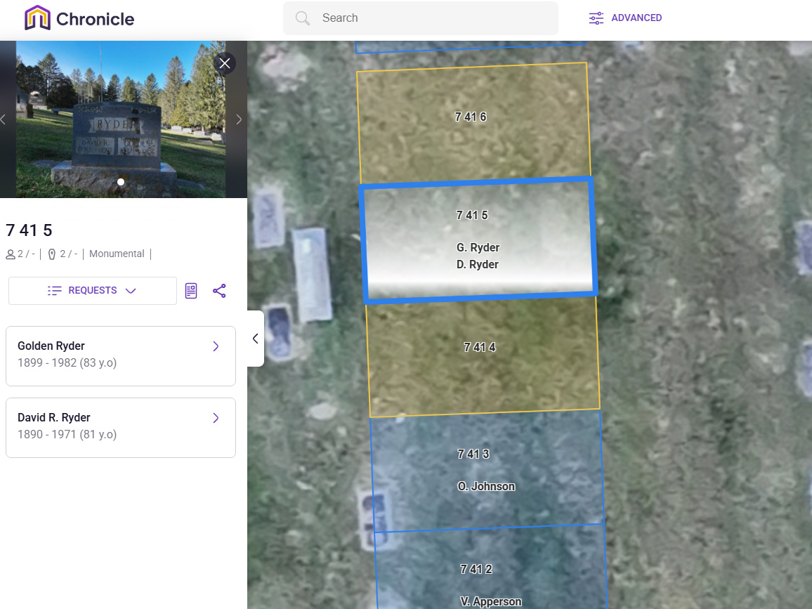
Make your cemetery’s history easy to manage with our clickable, searchable web maps, and ensure your recordkeeping is streamlined and user-friendly for future generations.
Our straightforward, no-annual-fee web mapping solution, provides an affordable and easy way to access and manage your cemetery’s data.
Our precision mapping services makes it easy to plan for future burials and maximize available space while maintaining the respect and dignity of existing sites.

Provide the best service to your visitors and maximize your cemetery’s potential real estate by mapping both marked and unmarked burial plots using GPR

Our Subsurface mapping solutions use top-of-the-line GPR equipment and come complete with accurate GPS coordinates and burial plot maps for your cemetery.

GPR works to locate unmarked or lost graves by sending radar signals into the earth to detect disturbed soil and voids in the earth.

Give your cemetery the modern upgrade it needs—without the hassle. Our new partnership with Chronicle lets you easily digitize records, pinpoint unmarked graves, and plan future plots, all from one convenient platform. Whether you run a small churchyard or a large municipal cemetery, our solution keeps you organized, saves time, and helps visitors quickly find what they’re looking for.
Sentry Mapping provides professional Ground Penetrating Radar (GPR) mapping services to cemeteries throughout North America. Our expert GPR technicians use state-of-the-art radar systems with high-frequency antennas to carefully and accurately map the subsurface landscape of your space.
Our world-class Ground Penetrating Radar systems send signals into the earth and record the reflections of those signals. These signal reflections show as a hyperbola on the system’s screen and will pinpoint underground anomalies allowing our technicians to mark their exact locations. This process creates a subsurface map of the area while causing no soil disturbance or any other damage to the site.
Ground Penetrating Radar allows you to get an underground view of your desired area. This provides a blanket of protection from costly digging errors and an otherwise inaccessible insight into the layout and features of your project’s subsurface landscape.

Sentry Mapping offers our clients across the U.S. professional geophysical testing with top-of-the-line GPR equipment. Each member of our team of GPR Mapping professionals is highly qualified and expertly trained in the use of these state-of-the-art radar systems.
FROM START TO FINISH
Contact us and our team of experts will answer any questions and discuss your specific needs.
Our experts review your cemetery via Google Earth, and send a proposal within one business day.
We visit your site to start data collection. This may take a day to several weeks depending on the size of your cemetery.
We process the field data and generate digital maps and records. This typically takes about 3 to 12 weeks.
We review the results with you and collect any feedback, corrections, and final approval.
You are sent a physical copy of the map, along with a web map link for easy access.
We’re here to help you streamline and simplify your record keeping with high-quality, accurate maps. We use the most modern GPR and GPS technology to provide exact renderings of your cemetery.

Save time, save money, and avoid frustration with highly accurate underground maps that can be used to minimize effort and excavation while allowing you to plan your burials with confidence.
Enjoy an up-to-date cemetery roster that was created for you and designed with accurate burial names and locations that will direct your cemetery’s visitors to their loved one’s resting place with ease.
Appreciate an accurate Burial Plot Map that identifies what burial spaces are available for purchase and creates a burial system for future burials.
Detect underground anomalies and disturbances including unmarked graves, USTs such as septic systems, and utility lines which aid in avoiding costly digging mistakes.
Preserving heritage at a 150-year-old cemetery.
Problem:
A 150+ year-old historic cemetery faced a significant challenge: it had no records or maps of its burial sites. This lack of documentation left the caretakers unsure about the availability of space for new burials, raising concerns about the preservation of the cemetery’s heritage and the respect due to those interred.
Solution:
Sentry Mapping Services stepped in with a comprehensive approach to solve the cemetery’s challenges. Utilizing advanced Ground Penetrating Radar (GPR) technology, the team meticulously scanned the entire area to locate unmarked graves. This thorough investigation was followed by the creation of a detailed map that not only marked every known burial but also included names, birth and death dates, creating a rich tapestry of the cemetery’s history. To complement this, Sentry Mapping provided a clickable and searchable web map, making navigation and management effortless for the caretakers—all at no additional cost.
Result:
Thanks to Sentry Mapping’s expertise, the cemetery now has a clear understanding of its layout and capacity for future burials. This newfound knowledge ensures that every inch of sacred ground is used respectfully and efficiently, honoring the memory of those at rest. Moreover, the digital tools provided have secured the cemetery’s heritage for future generations, making it easier for families and historians to connect with their past. The once uncertain terrain of the cemetery is now a carefully mapped and cherished space, its legacy preserved and its management streamlined.

Just like any other property, cemeteries need to be designed with the proper planning and forethought. Whatever…

A Guide On How To Own A Cemetery Business Starting your own cemetery can be a very…

What is Ground-Penetrating Radar? Ground-Penetrating Radar, or GPR, is a geophysical locating method that uses radio waves…
Your cemetery deserves a detailed map that shows every burial spot, both marked and unmarked. This makes managing your space easier, saving you time and trouble, and keeps your records up to date without any hassle. Our friendly team is ready to help you with any questions and guide you through every step of the process. Please fill out or form or give us a call at 901-490-6206.